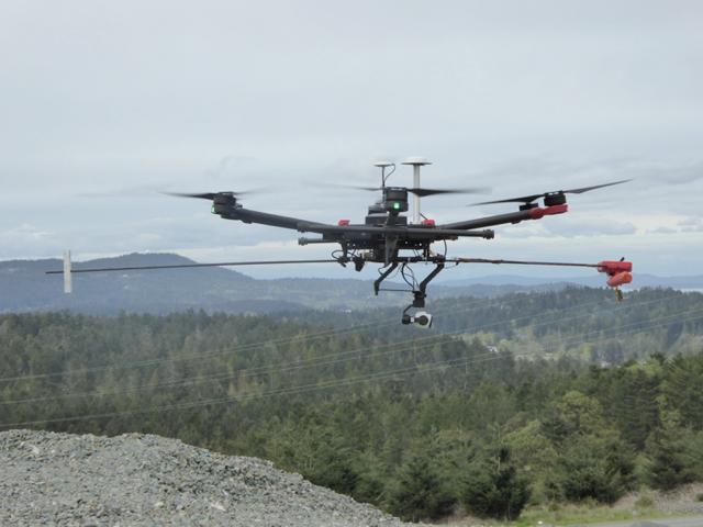
A GHGMap project drone
Laser technology will allow users to measure emissions from oil and gas wells and other sites
In the fight against climate change, there’s a new eye in the sky. Today (September 28) at the Union of BC Municipalities convention in downtown Vancouver, Geoscience BC launches the GHGMap project, which uses optical drone-mounted laser technology to detect and analyze aerial greenhouse gas emissions. Non-profit Geoscience BC developed the technology with the U.S. National Aeronautics and Space Administration (NASA). It will allow users to accurately measure emissions like methane, ethane and carbon dioxide from sites that may be high emitters, such as oil and gas wells, pipelines and other infrastructure, feedlots and landfills.
“Natural and human releases of greenhouse gases, such as methane, carbon dioxide and nitrous oxide, to the atmosphere present real concerns for climate change and air quality. Assessing and reducing these emissions requires reliable, uncomplicated measurements,” Dr. Michael Whiticar, GHGMap project lead, said in a statement. “Our new mini-optical instrument mounted on a small drone allows us to quickly and effectively make these measurements on regional and local scales in a completely novel approach. We believe that this new way of doing things will make a substantial difference.”
The event starts at 4:30 p.m. at the Vancouver Convention Centre.